
HIKE WITH US
VIENI IN ESCURSIONE CON NOI
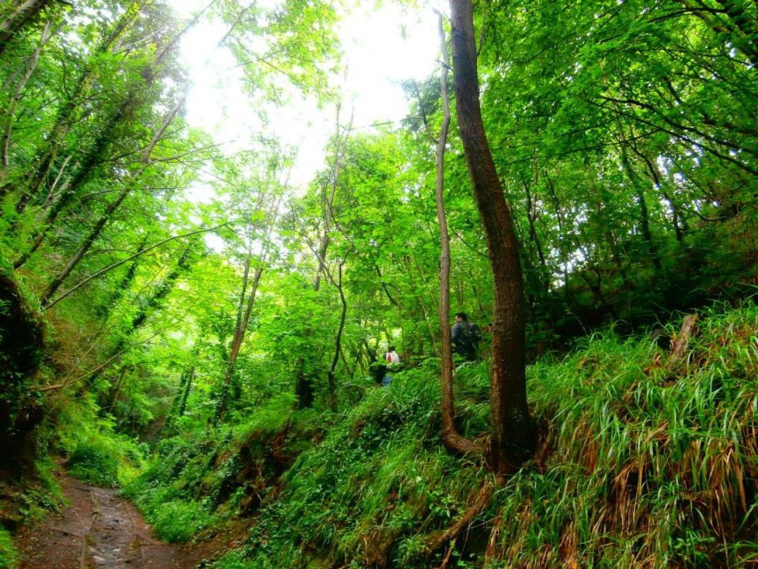
The paths where we practice our excursions are of various kinds and offer possibilities both for trekking lovers and for those who want to enjoy a day walking in suggestive places without facing any particular height difference. Very often, for our hikes, we do not follow the canonical routes but also walk off-path and unknown to most, allowing us to guide you to discover a new Vesuvius, which hides beautiful scenery and incredible resources.
In our hiking offer we propose the most beautiful and suggestive itineraries that will allow you to discover the Vesuvius National Park in a completely new way!
For all information on the costs and dynamics of the excursions, tips for good trekking, child-friendly routes, meeting places or simply to talk to us, please do not hesitate to contact us.
Excursions every day by appointment:
Call center: +39 329 13 40 500
e-mail: info@vesuvionatura.it
Page contact: CONTACT

Discover the natural beauty of Vesuvius
NATIONAL PARK PATHS
VESUVIUS PATHS
| Valle dell'inferno | Path 1 |
| Lungo i Cognoli | Path 2 |
| Monte Somma e punta Nasone | Path 3 |
| Riserva forestale Tirone Alto-Vesuvio | Path 4 |
| Gran cono del Vesuvio | Path 5 |
| Trenino a Cremagliera | Path 8 |
| Fiume di lava | Path 9 |
| Gran cono, Valle dell'inferno, e cognoli del Somma | Path 2-1-5 |
The paths in the 'Vesuvius National Park' vary in altitude, altitude difference, biodiversity and landscape. We have chosen the ones we like best for you!
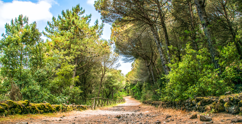
RISERVA FORESTALE TIRONE ALTO-VESUVIO
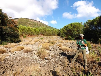
A beautiful, wide and well-equipped path in the Forest Reserve that crosses the famous Piano delle Ginestre (Broom Plain) and is one of the most protected and natural paths in the Park. The path stretches for about 1,500 m, is mostly flat (altitude 600 m) and crosses pine and ilex groves. The path, flanked by dry stone walls, makes it possible to cross one of the most beautiful and panoramic stretches of the entire park, which offers a continuous alternation of more enclosed and shady areas in the woods with open stretches in the scrub, both dominated by the view of Vesuvius. Along the way, we cross beautiful volcanic formations such as lava tunnels and rope lavas, and encounter no less than three lava flows dating back to the 1944 eruption colonised by pioneer species including the very famous Vesuvius lichen: Stereocaulon vesuvianum.
TECHNICAL DATA SHEET
| Total Length | 6 Km round trip |
| Maximum height | 625 m s.l.m. |
| Walking Time | 3 h round trip |
| Difficulty | EASY |

VALLE DELL'INFERNO
The path starts at an altitude of 965m and stretches for about 2500m, alternating between downhill and flat stretches. Due to the nature of the trail, it is the ideal route to observe the typical geological structure (strato-volcano enclosure) of Somma-Vesuvius. The Valle dell'Inferno separates Monte Somma from the younger volcano, Vesuvius, and is partly invaded by lava from the last eruption in 1944 colonised by the lichen Stereocaulon vesuvianum. A visit to the Valle dell'Inferno is an impressive walk to discover the eastern side of Somma-Vesuvius. During the walk, the grandeur of the volcanoes can be observed by looking down on Monte Somma and Vesuvius. After descending into the valley through different vegetation belts, we first reach the Arena and the Natural Arch and then the Cognoli di Levante on which is the most beautiful 'rope-like' lava formation on Vesuvius, incised by a deep fracture in which numerous species of ferns live and inside which it is possible to enter as if we were in the bowels of the earth! The path is also accessible by La Busvia del Vesuvio (the Vesuvius Busway), which allows you to visit the famous Brooms Forest.
TECHNICAL DATA SHEET
| Total Length | 5 Km round trip |
| Maximum height | 965 m slm |
| Walking Time | 3 h round trip |
| Difficulty | Medium |
MONTE SOMMA E PUNTA NASONE

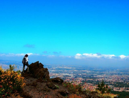
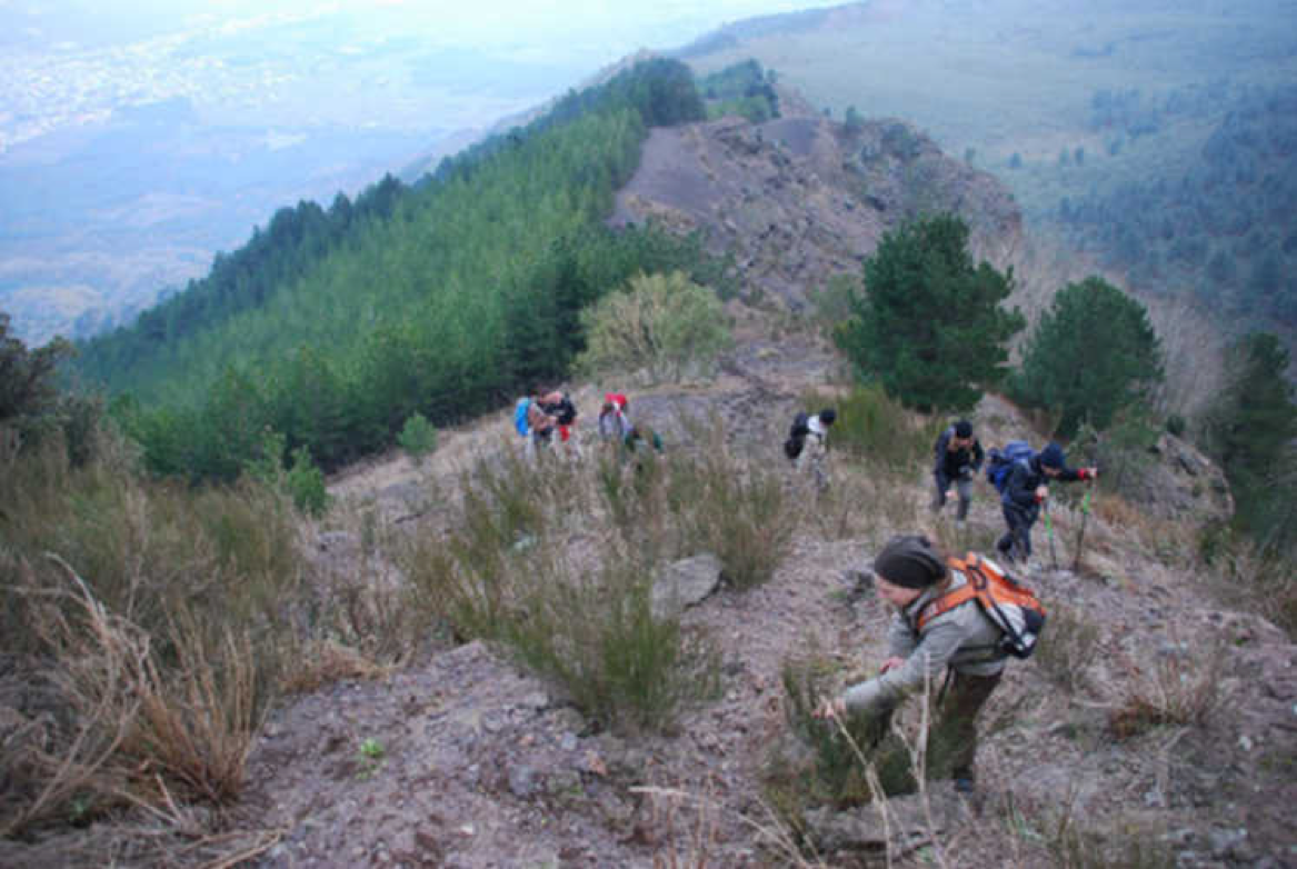
The Monte Somma and Punta Nasone hiking trail takes us along the ridges of Monte Somma, walking on the edge of the immense caldera formed during the eruptions of the ancient Somma volcano before 79 AD. This fascinating circular route leads up to Punta nasone, which at 1132 metres above sea level is the highest peak of Monte Somma. On the way, we first encounter the essences of the broom scrub, and then, as we climb towards the summit, the mesophyll wood of locust and chestnut trees, which in spring is punctuated by the bright colours of the inflorescences of the Vesuvian red lily. Along the route of the ridge, we first pass the Cognoli di Trocchia (961 m asl) and then those of Sant'Anastasia (1086 m asl), from which we can admire the Gulf of Naples and the Campana Plain on one side and the Tirone Alto-Vesuvius Reserve, the Gran Cono del Vesuvio and the Cognoli di Ottaviano on the other. When you reach Punta Nasone, you enjoy a breathtaking view over the Valle del Gigante below, where the lava river of 1944 is particularly impressive, and with a bit of imagination you can see it flowing again!
The last section of the itinerary cuts almost flat across the western slope of Monte Somma and crosses lush forests of locust, chestnut, downy oak, Neapolitan alder maple and many other species, and is affected by innovative naturalistic engineering works.
TECHNICAL DATA SHEET
| Total Length | 9 Km round trip a/r |
| Maximum height | 1131 m slm |
| Walking Time | 6 h a/r |
| Difficulty | Excursionist |
FIUME DI LAVA
The trail is very easy and alternates between downhill and flat stretches and uphill stretches with points where we proceed in single file. It starts at an altitude of 540 metres and follows an easy track of approximately 1400 metres that first crosses mixed woodland environments, with essences such as acacia, chestnut, black hornbeam and various species of oak, and reaches a scenic area. This area is dominated by scrubland environments, whose explosion of colour and life frames one of the most evocative views of the lava flow dating from the 1944 eruption, whose lavas and pyroclastic deposits are brushed with that silvery grey colour due to the growth on them of the very famous Vesuvius lichen: Stereocaulon vesuvianum. When you reach the lava, you can enjoy a breathtaking view of the Gulf of Naples and admire the Giacca and Trocchia Cognoli of Monte Somma and the western slope of Vesuvius. The entrance to the track is near the Vesuvius Observatory Museum. To reach the Vesuvian Artistic and Mineralogical Laboratory, however, it may be necessary to travel by bus. For the return journey, retrace the outward journey in the opposite direction. The entrance to the trail is near the Vesuvius Observatory Museum.
TECHNICAL DATA SHEET
| Total Length | 1.2 Km round trip |
| Maximum height | 568 m slm |
| Walking Time | 2 h round trip |
| Difficulty | Easy |
GRAN CONO DEL VESUVIO

The path that allows the ascent to the Gran Cono del Vesuvio starts from the former Park Ticket Office at an altitude of 1000m and reaches an altitude of 1175m, winding through a series of extremely scenic hairpin bends that allow us to admire the ancient volcano of Monte Somma, separated from Vesuvius by the Valle del Gigante and the Colle Umberto, the site of the Vesuvius Volcanological Observatory, the first in Italy founded in 1841. After reaching the Presidio delle Guide Vulcanologiche (Volcanological Guides' Office), a flat section begins and continues along a path with repeated views of the crater mouth. After reaching the Capannuccia locality, we continue downhill on the south-eastern slope of the volcano, reaching the old Piazzale located in the municipality of Ottaviano. The panorama you admire is of rare beauty and the route allows you to completely circumnavigate the entire volcanic edifice of Vesuvius and return to the starting point.
For the return journey, do NOT retrace the outward journey in the opposite direction.
* For this excursion it is necessary to purchase a ticket for access to the Grand Cone, which can be purchased online at this link
TECHNICAL DATA SHEET
| Total Length | 4 Km round trip |
| Maximum height | 1175 m slm |
| Walking Time | 3 h a/r |
| Difficulty | Medium |

LUNGO I COGNOLI
The hiking trail is extremely scenic and first crosses the Valle dell'Inferno, which separates Monte Somma from Vesuvius, and then continues into the mixed woodland of the eastern slope of Somma. The route alternates between flat and ascending stretches and allows you to enjoy the most evocative and wild scenery of the entire Somma-Vesuvius volcanic complex, passing through forest, scrub and even bare lava rock! In some places it is also possible to admire particular patches of black pine, which in the Vesuvius area is a 'glacial relict' and only manages to survive thanks to the cool northern exposure. After a long ascent along the ridge of the Somma volcano, we arrive in the broom scrub vegetation: here we are rewarded by a spectacular landscape that overlooks the entire volcanic complex and continues on the most striking ridges of Monte Somma, where the layer of lapilli from the last eruption in 1944 creates suggestive perspectives on Vesuvius with Colle Umberto, the Cognoli di Ottaviano and Punta del Nasone, while below we can admire the Canalone dell'Arena and the Valle dell'Inferno. From the Cognoli, past the crest, you descend along a steep stretch of lapilli to the Valle dell'Inferno, gliding as if on sand dunes!
TECHNICAL DATA SHEET
| Total Length | 11,5 Km round trip |
| Maximum height | 1,1 Km slm |
| Walking Time | 7 h a/r |
| Difficulty | Excursionist |
GRAN CONO, VALLE DELL'INFERNO E COGNOLI DEL SOMMA
This hike combines several paths in the park and is among the most complete routes to admire the Somma-Vesuvius volcanic complex from all points of view! The route starts from the square at 1000m altitude from which the ascent to the Crater of Vesuvius will be made. After reaching the Capannuccia locality, we continue downhill on the south-eastern slope of the volcano, reaching the old Piazzale located in the municipality of Ottaviano. From there, we will continue along a downhill stretch through the beautiful gorse grove overlooking the Strada Matrone path. When we reach a junction, we will take a diversion that will allow us to rejoin the Valle dell'Inferno path and, from the Piazzale della Legalità, we will begin our ascent up the Cognoli del Somma. We will then admire fantastic scenery over the entire Campana Plain and reach the panoramic terrace where the most beautiful "rope-like" lava formation of Vesuvius is located, incised by a deep fracture in which numerous species of ferns reside and inside which it is possible to enter as if we were in the bowels of the Earth! The path then continues along the Cognoli di Lavante of Monte Somma: a beautiful panoramic ascent on one of the most scenic trails in the entire park! Once at the top, it will be possible to descend to the valley along a steep stretch of lapilli and ash that leads to the Arena with the natural arch of the Valle dell'Inferno. From there we will then return to the starting point at an altitude of 1000m, the destination of the itinerary.
TECHNICAL DATA SHEET
| Total Length | 13 km round trip |
| Maximum height | 1100 m slm |
| Walking Time | 8 h a/r |
| Difficulty | Excursionist |
GRAN CONO* - STRADA MATRONE - VALLE DELL'INFERNO
TECHNICAL DATA SHEET
| Total Length | 7000 m a/r |
| Maximum height | 700 m slm |
| Walking Time | 6 h a/r |
| Difficulty | Easy/Medium |
For all information on the costs and dynamics of the excursions, tips for good trekking, child-friendly routes, meeting places or simply to talk to us, please do not hesitate to contact us.
Excursions every day by appointment:
Call center: +39 329 13 40 500
e-mail: info@vesuvionatura.it
Contact Page CONTATTACI
